Summary of major fires in south Wasco county during 2024
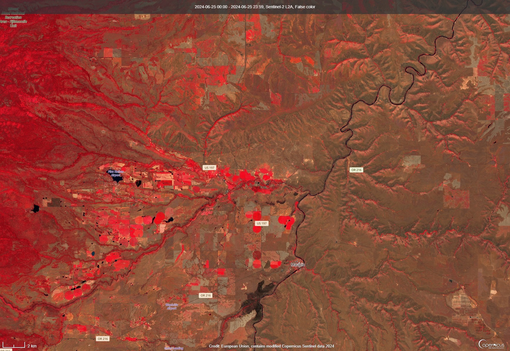
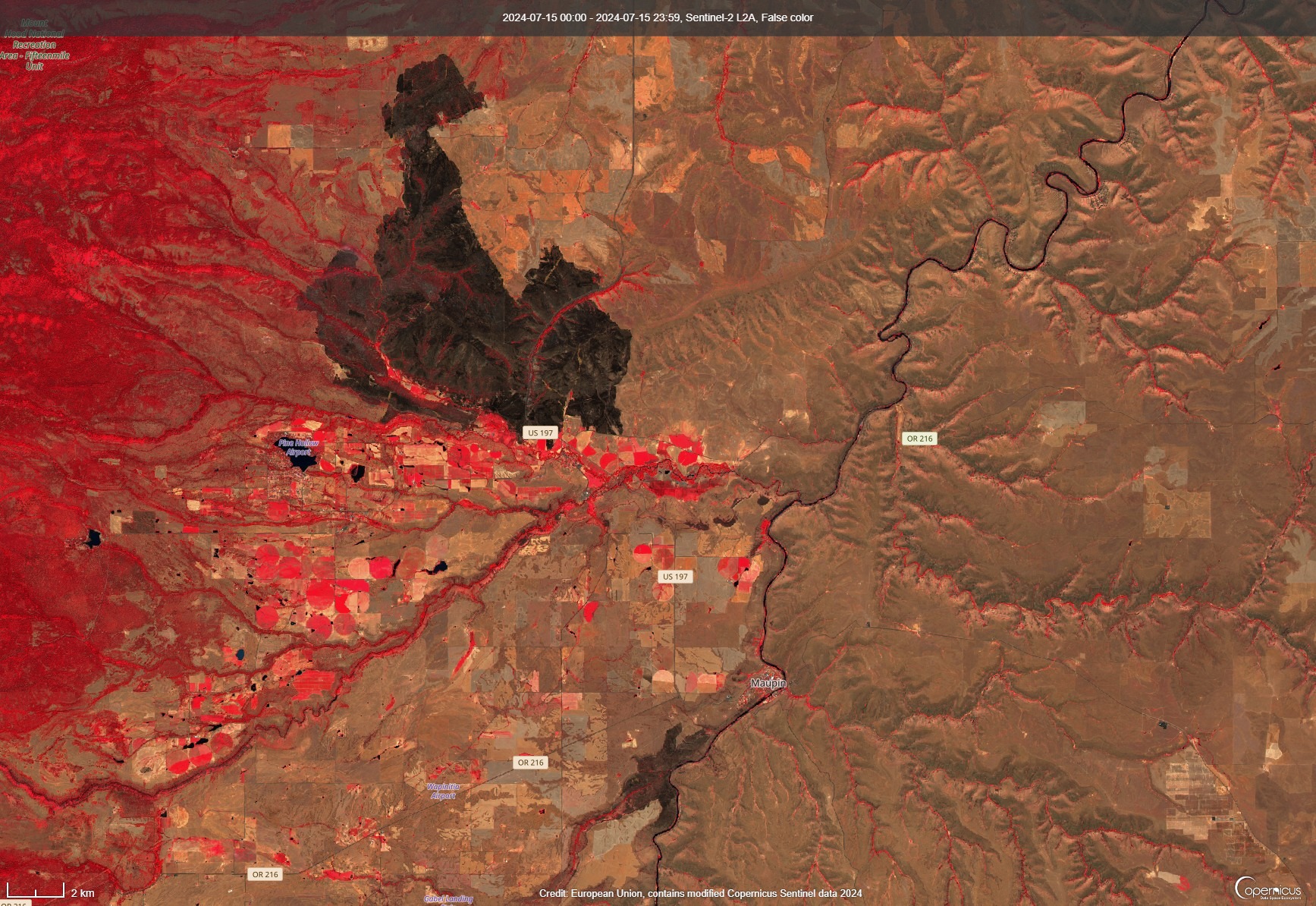
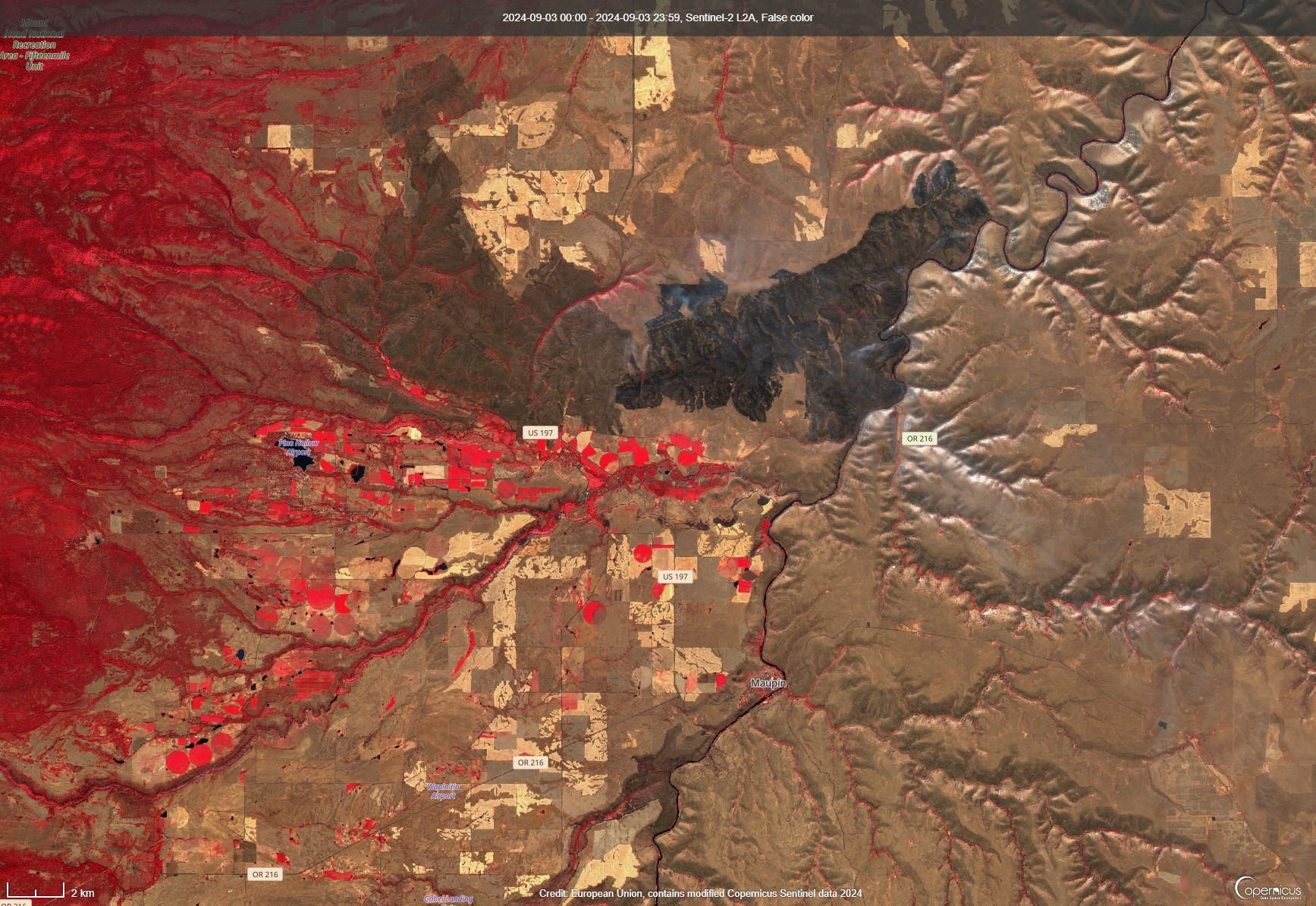
This page shows a sequence of three false color satellite images summarizing the major fires of the 2024 fire season in south Wasco county. Red in the images indicates vegetation; the fire scars show as black.
June 25, 2024
This image was taken by the ESA Sentinel 2 satellite shortly after the Long Bend fire. The small fire scar (around 1,000 acres) is visible at the bottom center of the image, just southwest of Maupin. Note the Deschutes river meandering northeast from the bottom center of the image to the upper right corner.

July 15, 2024
This second image covers the same region as the image above and now shows the Larch Creek fire scar extending north of Tygh Valley past Friend. The fire burned the western half of Tygh Ridge (crossing highway 197 eastward in Butler Canyon) and extended west into the Jordan Creek drainage. The fire began at the north end of the scar and progressed south toward Tygh Valley and Wamic, but was stopped by local and state firefighters on the ground and by helicopters and retardant drops.

September 3, 2024
This last image was taken by the ESA Sentinel 2 satellite shortly after the Oak Canyon fire. This fire, caused by lightning, burned most of the eastern half of Tygh Ridge and was stopped along the Deschutes river on the east and by state and local firefighters to the south before it could reach the lower part of Tygh Valley. Note that the earlier Larch Creek fire scar has begun to fade. Juniper Flat RFPD played a significant role in stopping both this fire and the Larch Creek fire before they could do much damage in Tygh Valley. These two fires were out of district for us; our participation was through mutual aid requests.
